Future developments in Wales will have to take into account future flooding and coastal erosion risk caused by climate change the Welsh Government has confirmed today.
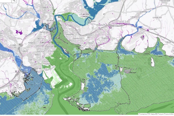
In a UK first, developers will have to work with flood risk and coastal erosion maps that have been made available today that not only show current risk levels, but also the risk posed by climate change.
The new planning policy advice known as Technical Advice Note 15, or TAN 15 for short, will inform future local development plans and decisions on planning applications in areas at risk of flooding and coastal erosion.
It will be used by the Welsh Government, local planning authorities and developers to direct development away from areas at risk of flooding and coastal erosion.
Climate Change Minister Julie James said:
“Flood risk and coastal erosion in Wales is increasing as a result of climate change.
“Serious flooding events are becoming more frequent and some areas currently at little risk will become vulnerable to flooding as our climate continues to change.
“As the National Strategy for Flood and Coastal Erosion Risk Management in Wales recognises, the planning system can help communities be more resilient to the effects of climate change by locating development in areas away from risk of flooding.
“Improved knowledge of the places which will be at risk in the future can help keep people safe, by preventing the damage and disruption to homes, workplaces and infrastructure that flooding can cause.”
TAN 15 is clear that new developments of homes, the emergency services, schools and hospitals, must not be located in areas of high flood risk without strong flood defences.
If a local planning authority is minded to approve any scheme against this advice, Welsh Ministers will be notified and able to decide the application directly.
The Flood Map for Planning identifies four types of flood zone, with each zone having particular advice in TAN 15 for proposed developments.
The flood zones are based on current risk levels with the addition of allowances for climate change. They therefore include areas considered likely to be at risk of flooding in the future, enabling planning decisions to take direct account of the expected impact of climate change on flood risk.
The Flood Map for Planning is published by Natural Resources Wales, and will be updated in May and November every year, to reflect the latest modelling and data on flood risks.
For all development in areas of low risk and areas protected by strong flood defences, and for less vulnerable developments in areas at high risk of flooding, securing planning permission will be dependent on passing the acceptability tests in TAN15.
These tests include providing justification for the location in a flood risk area, being on brownfield land and being resilient in the event of a flood.
The new TAN 15 and Flood Map for Planning have been made available today to allow planning authorities and developers to prepare for them coming into force on Wednesday, December 1.
From that date, all planning applications awaiting a decision, and all new planning applications, will be assessed against the new advice and map.
Any Local Development Plan under review and yet to reach the formal examination stage must also use the new TAN 15 and Flood Map for Planning after 1 December.

